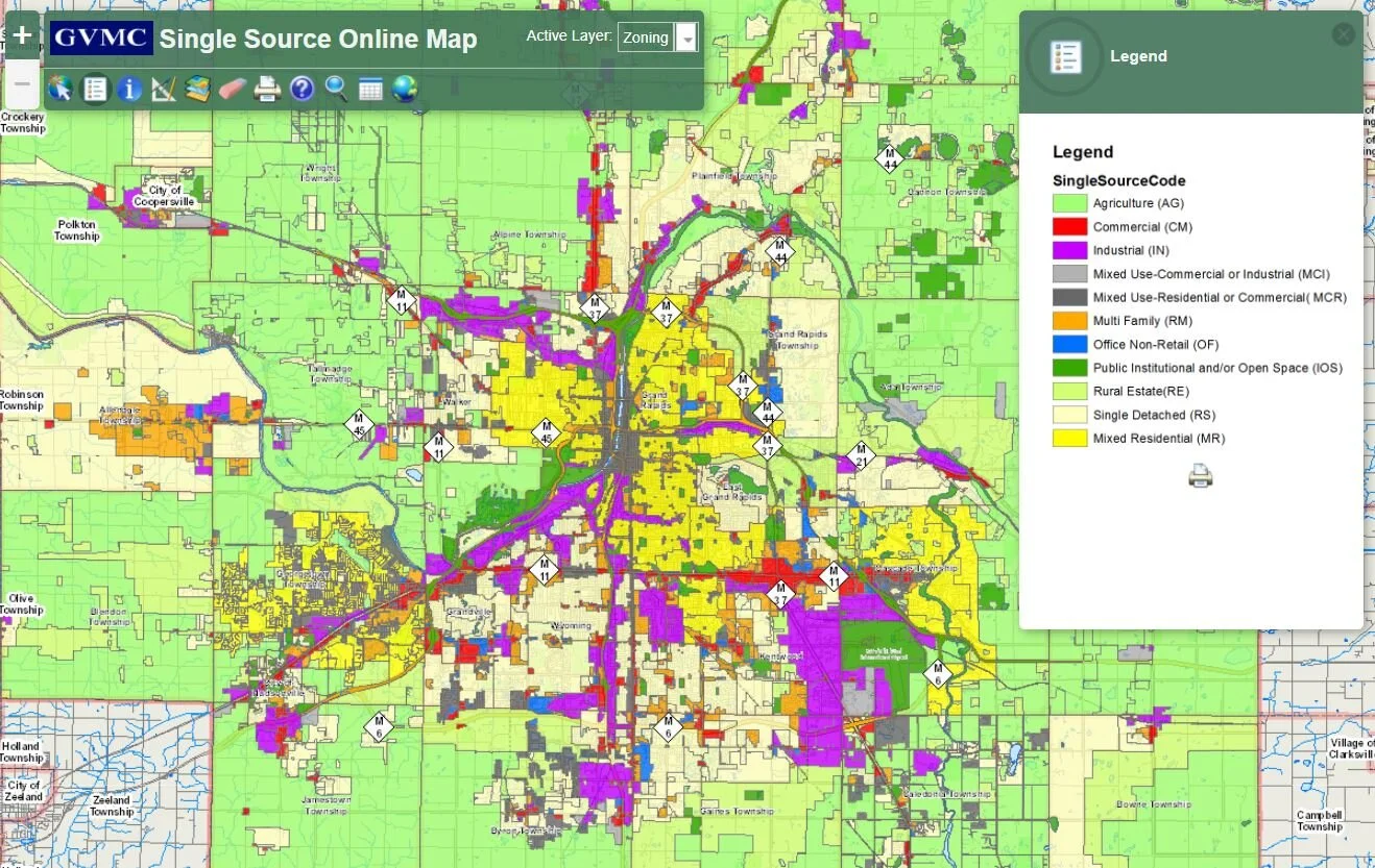
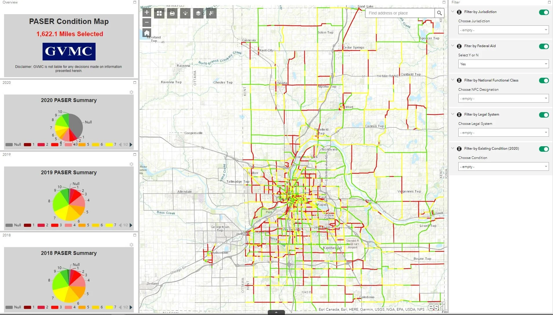
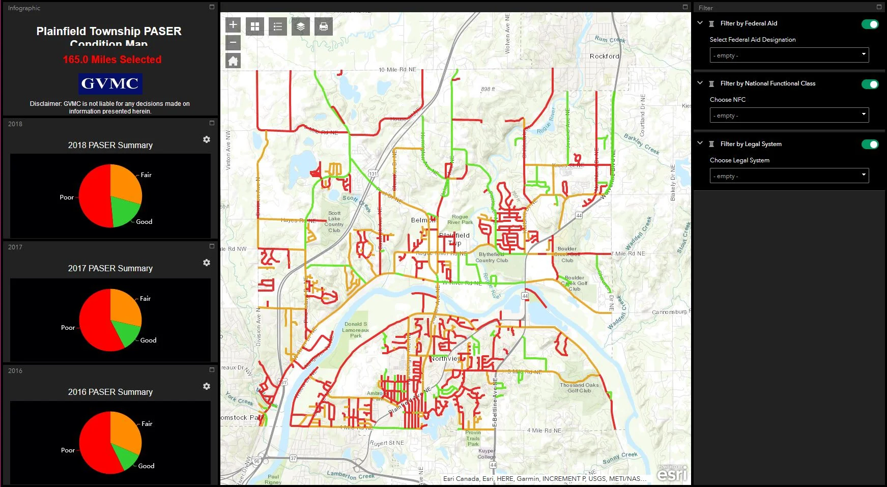
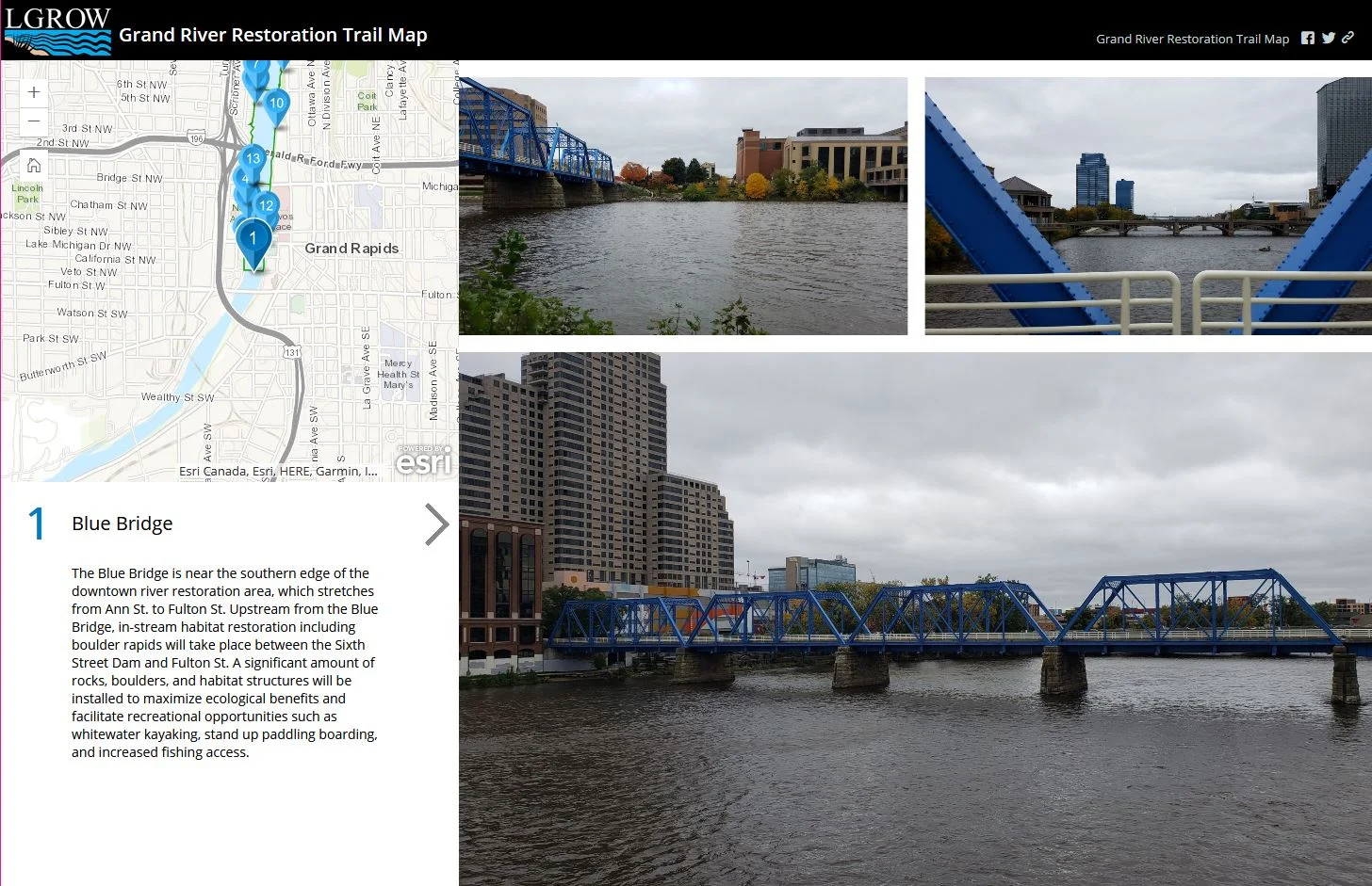
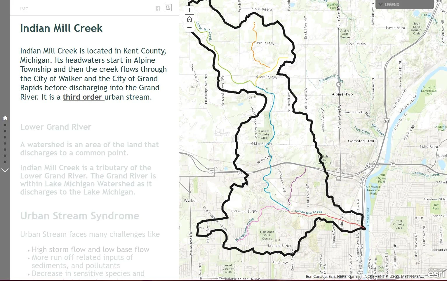
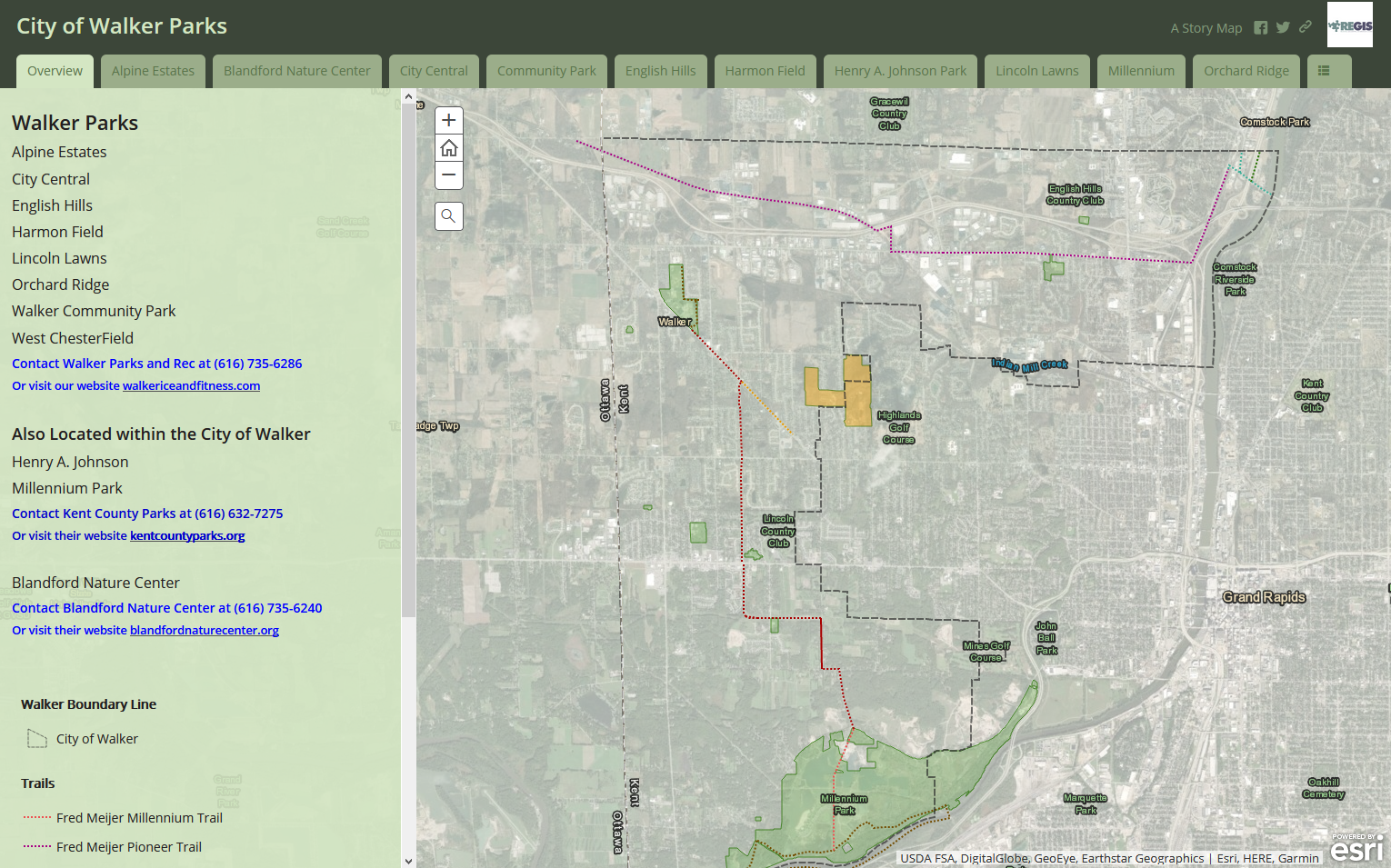
Map Gallery
The Single Source Map Viewer shows generalized codes for the region to provide a useful resource for GVMC programs/members, Regional Prosperity Efforts, Economic Development Partners, etc.
A map of images, Pavement Surface and Evaluation Survey (PASER) ratings, and Internation Roughness Index (IRI) condition data collected by the GVMC Transportation Department for roads in the GVMC Metropolitan Planning Organization (MPO) area.
This map includes PASER ratings for federal aid roads AND local roads for Plainfield Township.
Story map of the Grand River Restoration project. Learn about the history of the Grand River and the benefits of restoring it.
Walk the Grand River Restoration Trail and experience these important and historical sites along the way.
Storymap of the Indian Mill Creek. Learn about the Indian Mill Creek, Lower Grand River Watershed, Urban Stream Syndrome, and more!
A map created for the City of Walker’s Parks and Recreation Department. A useful tool to get details about each park within the City of Walker.