

Transportation Mapping Resources
As a service to the public, the Grand Valley Metropolitan Council Transporation Division is pleased to offer several different mapping services. Certain mapping services featured below allow users to interactively zoom, pan and query the map data and view a variety of mapping "layers," or types of information. These other mapping "layers" include streets and roads, aerial orthophotography, government units, railroads, parcels and more.
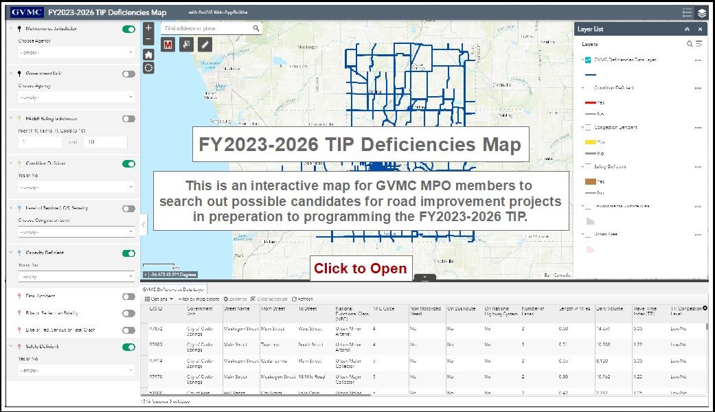
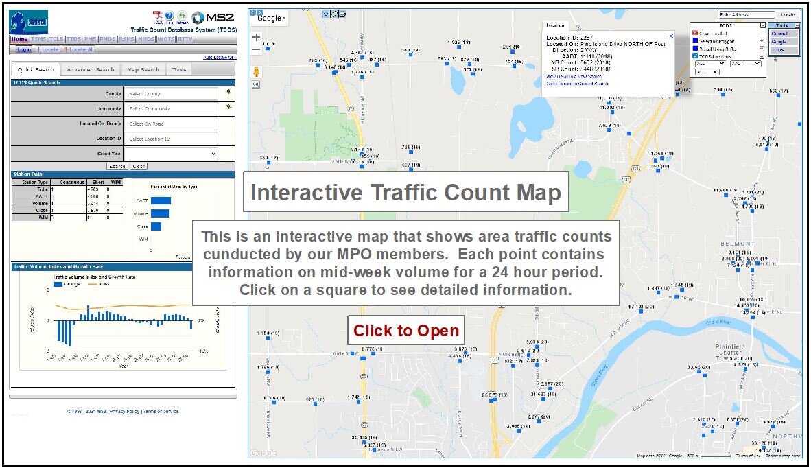
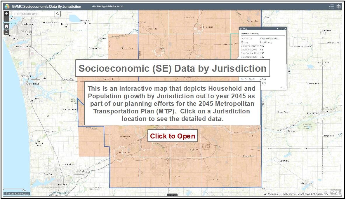
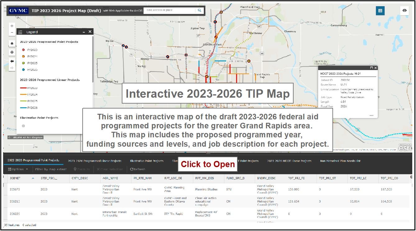
Please note: that this service is only for the Federal Aid Road network. If a community or road name is not available then there is no data available.
Transportation Internet Map Applications
Other Transportation Mapping Resources
In addition to the interactive mapping services above, below are links to a variety of other Transportation-related mapping sources: